Maps
Maps from Fred Shelley's facebook page
| Title | Link to Map | Source |
|---|---|---|
| U.S. Counties where more than half the population was born in another US state [1325x911] - Imgur | Imgur | facebook.com |
| National Park Maps Website Makes Hundreds of NPS Resources More Accessible Online - CityLab | citylab | facebook.com |
| In each state, what is the most popular "reality" TV show? | article | facebook.com |
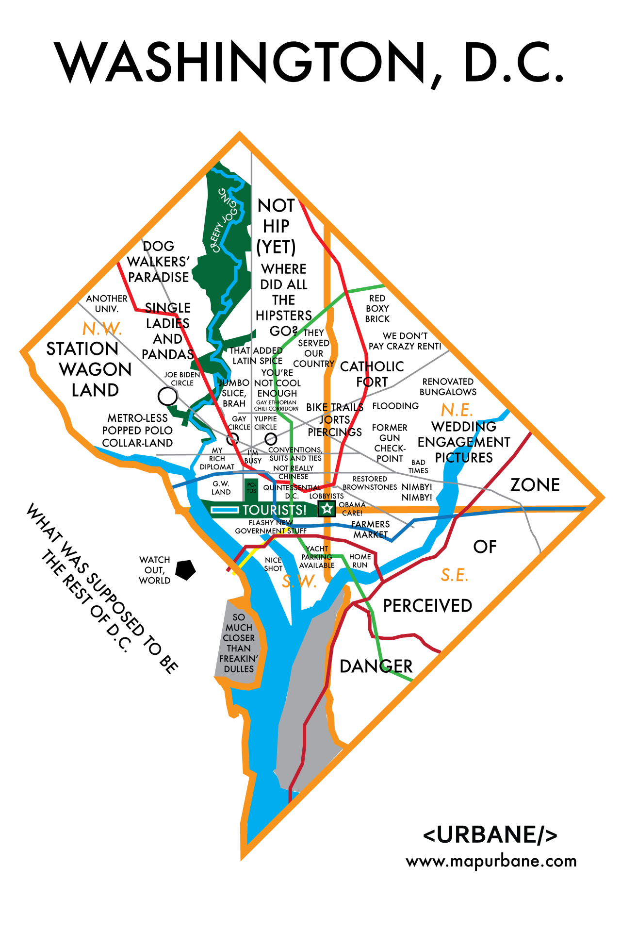
| Stereotyping areas within Washington, D.C. | image on tumblr | facebook.com |
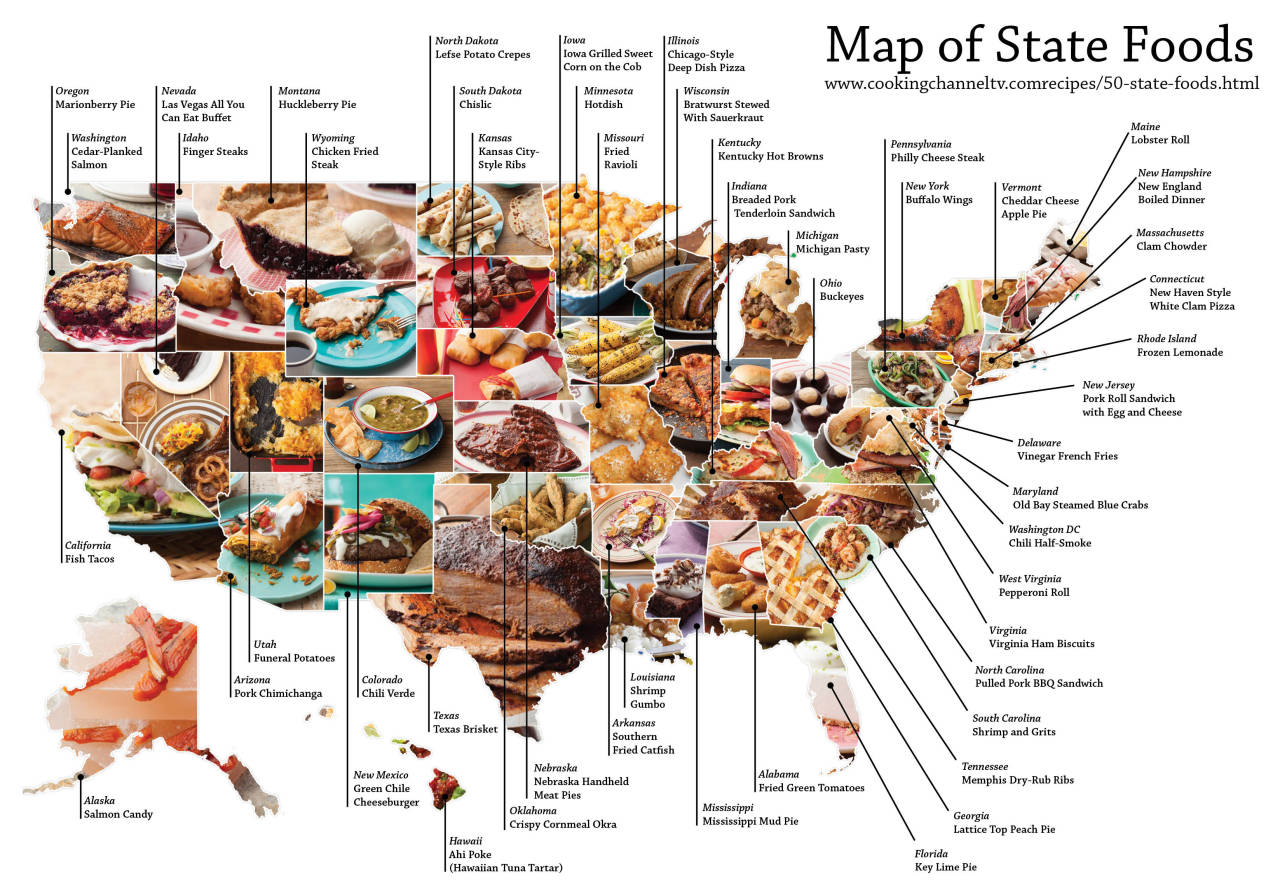
| prepared food dishes associated with each state | Image on tumblr | facebook.com |
| United Steaks of America map: If each state could have only one meat, what would it be? | article on slate | facebook.com |
| Regions of New York [OC] [950x640] - Imgur | image on imgur | facebook.com |
| Homicide: Pittsburgh and Allegheny County | Post-Gazette page | facebook.com |
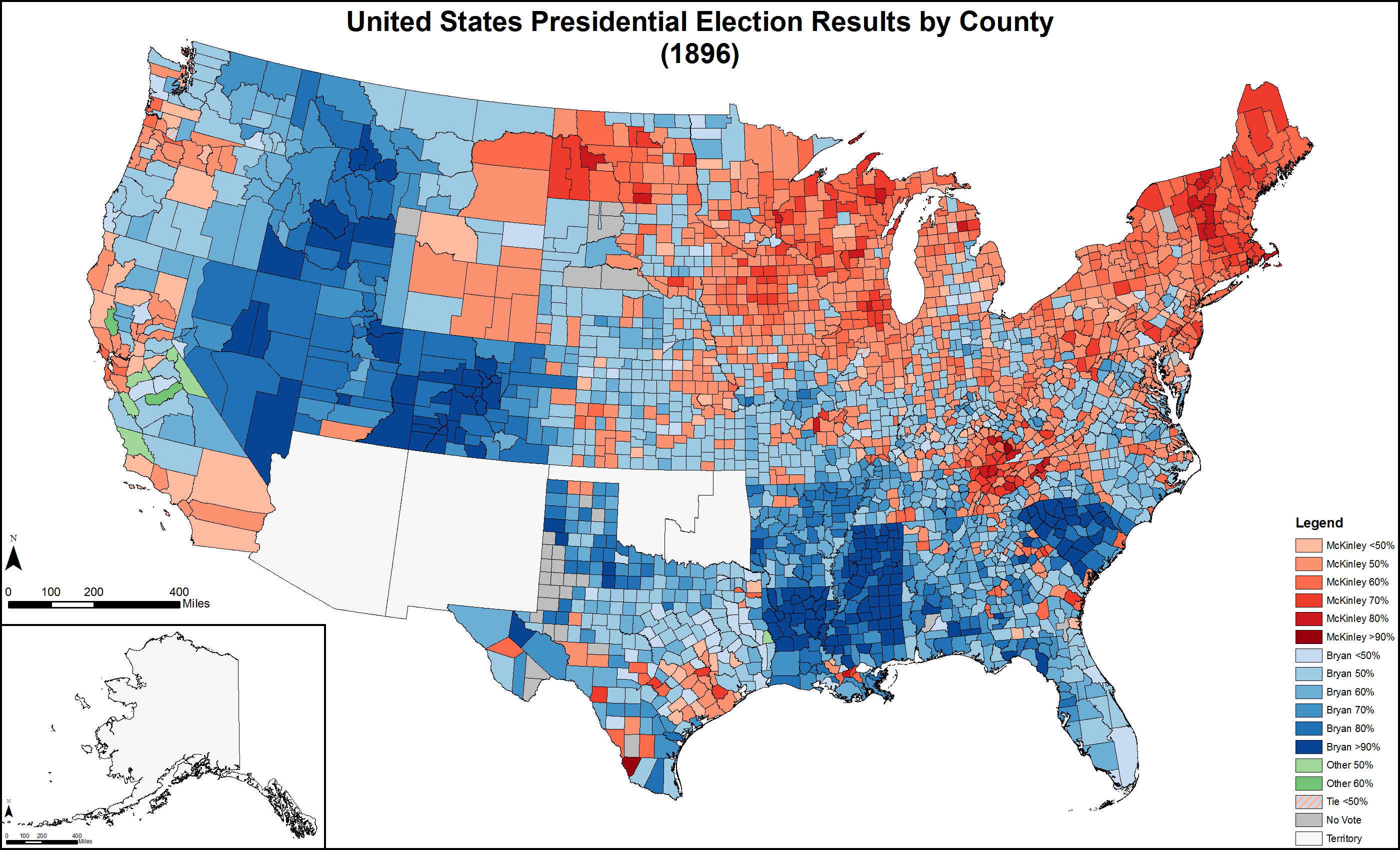
| United States Presidential Election Results by County (1896) | Map on wikipedia | facebook.com |
| YouGov-US-Personality-Map-Hi-Res-01-1024x583.png (1024×583) | Personality Map | facebook.com |
| diurnal-land-surface-temp.png (1248×612) | map | facebook.com |
| GENDER AND COLLEGE ATTAINMENT | metricmaps.org | facebook.com |
http://blogs.voanews.com/all-about-america/files/2015/02/YouGov-US-Personality-Map-Hi-Res-01-1024x583.png add a row: |[[?title?]] |[?map-link? ?Link Name?] |[?sourceURL? Link] |-